By Ali Becker
The Great Granby Loop is a moderately challenging 475 kilometer/295 mile bikepacking route that starts and ends along the shorelines of Lower Arrow Lakes in British Columbia’s beautiful and mountainous, West Kootenay region.
The route offers a balanced mix of well-maintained rail trails, challenging logging road climbs and fast flowing descents. Long stretches of dirt tracks are linked together by short, scenic and serene paved roads, and speckled with BC rec sites which offer free, rustic camping at stunning locales.
The Great Granby, named after the majestic river that runs adjacent to a section of the route, takes travelers through numerous eclectic Kootenay communities, full of character and characters and brimming with small town charm.
Bikepackers are likely to feel a deep appreciation for and connection to the forested landscapes as they roll alongside traditional Indigenous migration routes such as the pristine waterways that long sustained the Sinixt, Ktunaxa and Secwépemc peoples.
The route rolls back in time through turn of the century mining towns, Doukhobor settlements, Japanese internment camps, draft dodger hideaways, farming and forestry communities, cannabis-centric hippie havens and present day recreation destinations which are slowly being discovered.
Most of the small villages on route offer resupply options in the form of grocery stores, farmers markets, restaurants, cafes, liquor stores and gas station convenience food. Many host a municipal or private campground, a hotel or motel, a few AirBnBs and a small hardware store.
The bigger centers along the way, such as Castlegar, Grand Forks and Nakusp, offer all of the above, as well as bike shops and/or outdoor stores, breweries, museums, art galleries, rec centers (with saunas and showers) and laundromats.
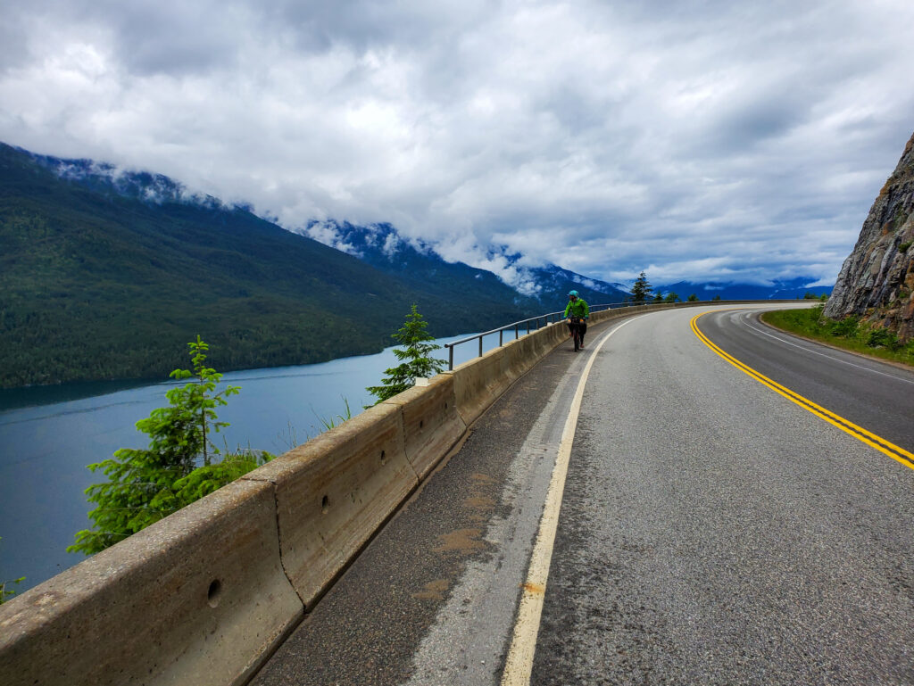
The route includes a short, free cable ferry crossing along the Upper Arrow Lakes which, on a clear day, gives way to some brilliant views of the stunning Monashee mountain range.
*See the Must Know tab for information about timing for the ferry crossings.
As the route traverses next to many crystal clear rivers, lakes and streams, fresh mountain water is abundant throughout most of the journey. In the high heat of summer, some of the smaller streams will be dried up, and it is always advisable to filter wild collected water.
Cell service is extremely limited throughout the route, so a satellite communication device is your best bet to stay in contact or get help should an emergency situation occur. There are hospitals in Castlegar, Grand Forks and Nakusp with a larger regional hospital in nearby Trail.
The Kootenays see their biggest increase in adventurous, outdoor recreationalists through the summer months (early July to early September) so shoulder seasons and mid-week travel will provide more opportunities for quiet roads and quaint campsites.
Though ‘busy’ is never really that busy.
There are a few longer sections of ~100km of trail that don’t have any resupply options along them. Some cyclists will not be able to or will not want to travel these stretches in one day.
It’s best to stock up on extra calories for the stretches between Castlegar and Grand Forks, Grand Forks and Edgewood, and again between Nakusp and New Denver.
*At Nakusp, riders will have the option to choose their own adventure – either climbing up the rugged and remote Wilson Creek FSR that gives way to ample alpine lakes with rec sites to swim, fish or camp, or along the mellower, equally stunning N & S (Nakusp & Slocan) Rail Trail to Rosebery where the routes will merge together on the Galena Trail. Wild camping options will be available along the rail trail.
The entirety of the route runs through remote, wilderness lands which are home to black bear, grizzlies, cougars, coyotes, and wolves. Be sure to tie your food up at night and bring bear spray. As bikes are quiet and can sneak up on animals, making sporadic loud, human noises can alarm animals of your approaching presence and ward off any unwanted, surprise encounters.
Once you enter Boundary Country beyond Christina Lake and into Grand Forks, you are in a rare desert-like region which is home to the Northern Pacific Rattlesnake, the only venomous snake in BC, which likes to sun on the warm roads in the high heat of summer.
Watch where you step, sit and set up camp. They, like most wildlife, shy away from human interaction and don’t take kindly to being poked at, or picked up.
For the full route: https://ridewithgps.com/routes/42401255
HIGHLIGHTS
The 1KM long Bulldog Tunnel along the C & W Rail Trail (headlamp recommended) and the restored trestle bridges along the route
The stunning stretch of desert-like rail trail between Christina Lake & Grand Forks along the Kettle River, the restored trestle bridge, sandy swimming holes and summer cliff jumping spots
In Grand Forks, The Wooden Spoon Bistro for breakfast, The Boardroom Cafe for coffee, the Grand Forks Brewing Co. for beer and Gallery 2 for arts and culture
The fast rolling stretch of pave between Grand Forks & the Burrell Forest Service Road that shares space with the routes namesake, the sparkling Granby River
The wicked descent from the summit of the Burrell FSR (which becomes the Worthington FSR) into Edgewood
The view across Upper Arrow Lakes from the Edgewood campground and the free, hot showers
Cliff jumping off the tall rocks at Hippy Hole as you climb towards Whatshan Lake
The remote, rustic BC rec sites perched alongside the alpine lakes
In Nakusp:
- The optional (but worthwhile) 13km paved (and quiet) climb up to the Nakusp Hot Springs (which offers tent camping at $20/night and a great descent the next morning)
- A night at BC’s oldest and longest running hotel – The Leland
- Tapas at Bella Soriah, pizza and craft beer or local cider at Arrow & Anchor
- Mountain biking and camping at the newly established Mount Abriel Rec Site (15 km road ride outside of town)
- Locally made sweets at Jennifer’s Chocolates
- The vintage bike museum at Shon’s bike shop
- The majestic views of the jagged, snow capped peaks in the Valhalla Provincial Park as you climb from Silverton, up and over to Slocan City
- Any of the smoked meat sandwiches the The Grizz Food Truck at the Mountain Valley Gas Station in Slocan City
- The entire, sacred stretch of the Slocan Valley Rail Trail (SVRT) which follows Slocan Lake & Slocan River for 50 stunning kilometers
- Breakfast at the eclectic Frog Peak Cafe at the south end of the SVRT
- A brisket dip sanger and cold BC craft beer at the Lions Head Pub, a small detour of the route near the end of your journey
For more info on bike touring check out:
www.bikepack.ca/the-great-granby-loop
GOOD TO KNOW
CAMPING
BC Rec Sites are free, rustic campsites speckled along the route with flat spots, picnic tables, and outhouses and are often nearby to a water source. They are noted on the map. They can get busy during peak season, but if you get creative there is always a spot to pitch a tent.
Wild camping is possible throughout the route, try to set up at dusk and pack up by dawn if you are in highly trafficked areas, and of course, leave no trace. There are pay campgrounds highlighted on the route, and a few others which aren’t mapped.
Most towns along the way will also have hotels, motels, airbnbs or other options for indoor accommodations. Consider booking ahead in busy season.
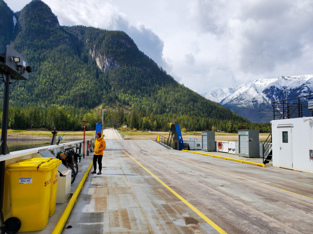
ARROW PARK FERRY
Arrow Park Ferry is a small, cable ferry that links the west side of Upper Arrow Lakes to Highway 6 towards Nakusp.
The cable ferry operates on demand daily from 5A – 9:20P with a lunch break between 12:05 – 2:15P and the barge is free to ride.
GETTING TO THE START
While the route can be picked up in any town along the way, we feel that Castlegar is the best start and end destination as it is easy to get to, has all the amenities you need and gives the loop the optimal amount of flow and balance.
Riding the route the way it has been plotted makes for the most amount of descending and more enjoyable ascending.
PARKING A CAR
The City of Castlegar has a few well-lit, frequently patrolled, public parking lots located near the downtown core, close to grocery stores, restaurants, cafes, the Cycology bike shop and the police detachment.
There is also ample residential street parking available near the north end of town. A large, dirt parking lot is available at the beginning of the C&W Rail Trail but is remote, dark and rarely if ever, patrolled.
You can also park for a fee in a secured lot at West Kootenay Airport in Castlegar.
FLYING IN
Castlegar is serviced by the West Kootenay Regional Airport. If you fly in, you can catch a local bus for the short ride into town with your bike box, or set up your bike, ride across the highway, go left on Heritage Way and take the trail at the end of the road down to the bridge into town. Here, you’ll pick up the Green Line Cycling Path.
Along the main road, you’ll be able to stock up on everything you need in terms of food, beverage and last minute bike needs for the remote, 115k to Grand Forks. (It is 90 km to Christina Lake, but resupplying there involves a big descent into town.)
BY BUS
BC Transit runs regional buses that come to Castelgar from Nelson and Trail everyday, route 99 and 98 respectively, that will drop you off at the Castlegar Community Complex to catch the route. There are two bike racks on the front of the buses that only fit up to 2.5” tires.
You will have to remove your bags from your bike before putting them on the front racks. Most bus operators will NOT let you bring bikes inside, or use the racks during dawn or dusk as they block the front headlights.
Mountain Man Mike’s is a private bus company that runs from Vancouver through Casltegar on Thursdays and Sundays and allows you to bring a bike (in a bag or box) for a $80 fee.
SilverCity Stagelines runs from Kelowna to Castlegar everyday and allows bikes for a fee.
WHEN SHOULD I RIDE IT?
Generally speaking, the Great Granby Bikepacking Loop can be ridden from early June until late September.
Depending on the winter snowpack and current spring conditions, the route may still have snow at higher elevations in late May and early June.
You can consult the C & W Rail Trail Facebook page, or message the folks at Trails to the Boundary to inquire about current conditions. High points are the Paulson Summit and Burrell Summit, but the Wilson Lake Road can be shady and snowy until mid June too. (There is always the alternate N&S Rail Trail)
Forest service roads (FSRs) tend to be in their peak condition in the spring shoulder season, barring that not too much rain has fallen or they haven’t been recently graded. Logging roads can get dusty and washboardy in the summer after frequent travel by cars, while rail trails can get softer and looser as the season goes on.
Roadways and trails are quieter in the shoulder season, June and September, and mid-week travel is mellower than the weekends.
We recommend heading out on the secondary highway stretches between Arrow Park Ferry and Naksup, as well as New Denver and Slocan early in the morning, and/or mid-week to avoid traffic.
Wear bright colors and bring a rear blinking light on the roadways. Always give logging truck traffic the right of way, and pull off to the side of the road when you hear big machines coming.
WHAT BIKE SHOULD I BRING?
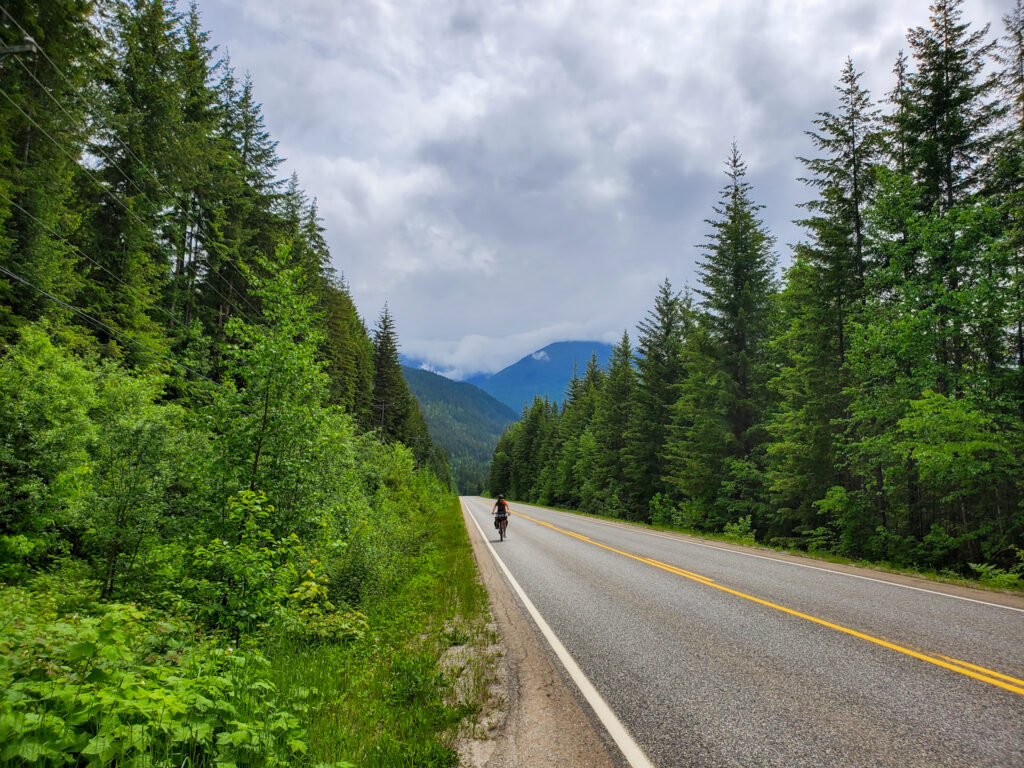
With the fluctuations in the quality of the forest service roads depending on weather conditions, and the lack of truly technical singletrack, you could enjoy the route on a rigid 26, 27.5 or 29er bike with 2.2 – 2.5” tires.
Bigger rubber will lack efficiency on the paved portions of the route, but it will be a worthy trade off as most of your time will be spent off-road on ever changing terrain.
PROPOSED ITINERARY
This is a proposed itinerary for a fit bikepacker looking for a moderately challenging route, who wishes to stay in towns along the route (as opposed to Rec Sites/wild camping)
CASTLEGAR, BC to GRAND FORKS, BC – DAY ONE – 115KM / 1188m elevation
After loading up and rolling out of Castlegar, it’s 115km to Grand Forks along the Columbia as Western (C & W) Rail Trail, which is part of the Trans Canada Trail (TCT). While it is a rail trail, never to exceed 3% grade, it is a steady climb from the shores of the Lower Arrow Lakes to the summit at the Paulson Bridge.
The C & W is a mixed-use corridor and has recently been widened and resurfaced to make way for vehicles accessing the remote, shoreline communities. Be sure to watch for motorists, horses, and ATVers and keep an eye out for the resident Grizzly bear who resides near the big blue bridge at the Paulson Summit.
There are sheltered picnic tables and nearby pithouses along this stretch at many of the old train stops, some of them offering plaques with historic accounts of that particular area.
After hitting the high point on the C & W, you are treated to a riveting dirt descent towards Christina Lake, one of BCs warmest tree lined lakes. A swim or resupply involves a decent dip down into town, but there are a few options for restaurants, grocers and accommodations if you’re so inclined.
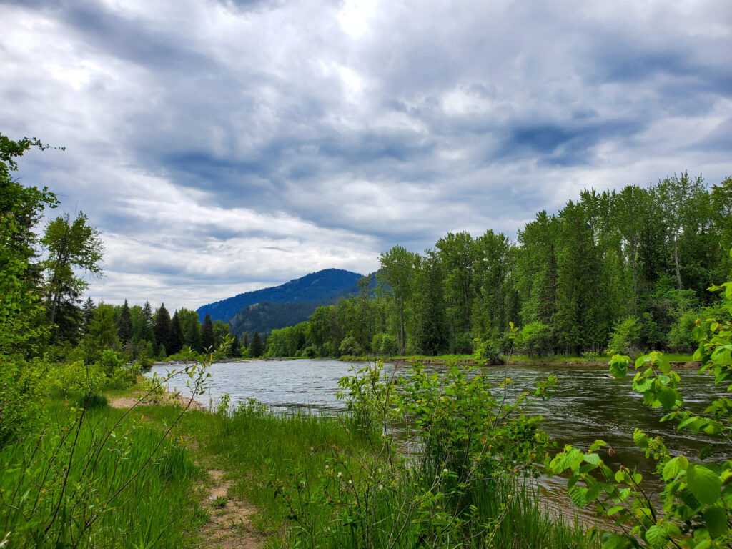
Otherwise, continue another 20 kilometers along the C & W next to the majestic Kettle River into Boundary Country along restored trestle bridges that carry you over deep gorges, rushing with water in spring, or mellow for a swim in summer.
Grand Forks is a great place to resupply on food, camp fuel, cold beverages and any last minute supplies before heading into the upcoming remote section and get some rest for the challenge ahead.
If you’re through on a Friday, make sure to check out the Farmers Market or swing by the Wooden Spoon or Boardroom Cafe for a great breakfast and delicious coffee. The Grand Forks Brewing Co. serves up some nice craft beer, and a sunny front patio with an adjacent food truck, making for an excellent spot to people watch.
Seasons Bike shop had parts and repair services and Fresh Tracks Outdoor Store sells camp goods.
Grand Forks has a municipal campground and plenty of motels and hotels to spend the night.
GRAND FORKS, BC TO EDGEWOOD, BC – DAY TWO – 115KM, 1096m elevation
After stocking up on supplies, the route cruises through town on the Trans Canada Trail and takes a turn along North Forks Road which parallels the graceful Granby River. This stretch of serene valley bottom features a fun, flowy, fast traverse of quality pavement shared mainly with birds, bees and a light breeze.
At the confluence of the Granby River and Burrell Creek rests the wide, flat and spacious Burrell-Granby BC Rec Site with a handful of camp spots, pit houses, picnic tables and a great map of the forest services roads (FSRs) in the area.
After this, the route turns to dirt, starting as the Gable Creek FSR before turning north and gradually climbing its way along the Burrell Creek FSR towards the summit. There are no official camp spots along the Burrell FSR, but you’ll find a few makeshift pull outs that will do in a pinch.
Once up and over the Burrell, you connect to the Worthington FSR and get rewarded with a wicked descent into the eclectic village of Edgewood.
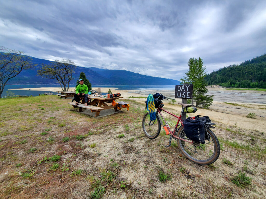
Edgewood is home to a beautiful lakefront campground with hot showers and stunning vistas, it’s a great spot to pitch a tent. The gas station/general store is a short ride from the campground, has great hours, loads of groceries, a small selection of hot food as well as alcohol, camping supplies and plenty of miscellaneous items.
This is another great place to resupply before heading onto remote Whatshan Lake.
EDGEWOOD, BC TO NAKUSP, BC – DAY THREE – 85 KM, 1063m elevation
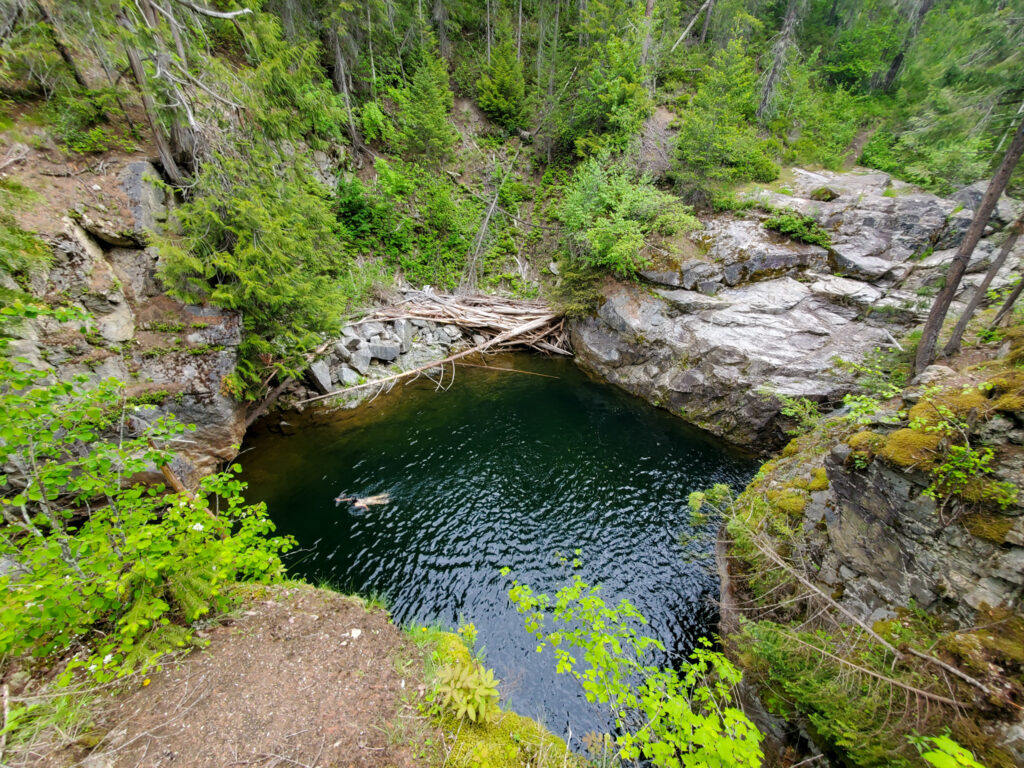
After a cruisy ten kilometers of paved road through the Edgewood Valley to the junction with Highway 6, the route turns right and grinds up the road to the Whatshan Lake Road turnoff.
This dirt road takes travelers towards Stevens Creek & Richy Rec Site, both of which are nestled along the shores of Whatshan Lake and can be busy on weekends in the summer.
Stay left on Whatshan Lake Road to hit the Hippy Hole, a great cliff jumping and swimming spot for those super sunny days. Park your bike by the barrier and walk in.
Both Richy Rec Site & Stevens Creek Rec Site offer beautiful (and free) lakeshore camping, pit toilets, picnic tables and beautiful views of the Monashee Mountains. No matter the crowds, it seems there is always somewhere to pitch a tent.
From here, the route continues along Whatshan FSR before connecting with Stevens FSR and descending gleefully to the Arrow Park ferry.
Arrow Park Ferry operates on demand daily from 5A – 9:20P with a lunch break between 12:05 – 2:15P and the barge is free to ride.
Once you arrive on the other side, you’ll quickly connect with Highway 6 for an enjoyable ride along the east side of Upper Arrow Lakes to the town of Nakusp. The road is relatively quiet mid-week and especially quiet in shoulder season. Since the road is capped by the Fauquier-Needles ferry traffic on one end, vehicles mostly come in short spurts.
Nakusp is another great place for resupply and provides lots of good restaurants, local grocers and tasty treats, as well as camping grounds, glamping options, hotels and motels and a laundromat.
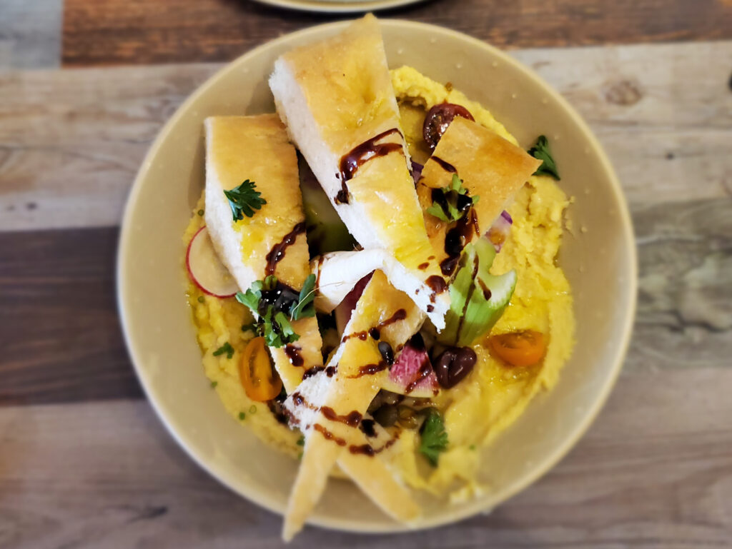
Be sure to try the tapas at Bella Soriah, the pizza and Angry Hen Beer or Burton City Cider at Arrow and Anchor, the locally made artisan chocolates at Jennifer Chocolates, the coffee at Mountain Top Cafe and the beef jerky at Jill & Hoss’s Bistro.
You are also close to the Nakusp Hot Springs, a steady but worthwhile 13km paved climb (+420m) that starts just 2km north of town. There are a few small cabins to rent and plenty of tenting space up at the hot springs.
Nakusp is also home to Shon’s Bike Shop, which provides an opportunity to get any bike maintenance and parts you might need and has a cool bike museum within it’s walls. The next section of riding is remote and without cell service or resources, so best to be prepared for anything.
NAKUSP, BC – SLOCAN CITY, BC – DAY FOUR – 95KM, 1664m Elevation
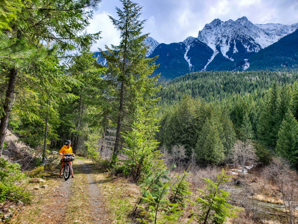
From Nakusp, the route climbs out of town on the recently repaired Nakusp & Slocan (N & S) Rail Trail. You’ll ride the dirt until you cross paths with Wilson Lake Road.
Here you can choose to ascend an exciting and at times, rough and rocky, but quiet and adventurous forest service road that passes by multiple freshwater lakes, and BC rec sites, each providing picnic tables, pit houses, free places to pitch a tent and easy access to the water.
OR
Take the mellower, but equally stunning N & S Rail Trail towards Rosebery where the routes will reunite.
On Wilson Lake Road you will pass Wilson Lake, Little Wilson Lake and Beaver Lake and then rip down the dirt road alongside raging Wilson Creek.
The Wilson Lake Road pops out at Rosebery, where you can choose to visit the Rosebery Provincial Park or continue across the highway to connect with the Galena Trail towards New Denver.
New Denver is home to New Market Foods grocery, the unique Adventure Domes accommodations and Wild Cycles of Canada, run by Rob Ferrell’s a local trail builder who fixes bikes on the weekends in a historic character home on the main street.
From New Denver, the route follows Highway 6 through the charming, historic town of Silverton which has great snacks and coffee at the Silverton Camp Cafe and offers a glimpse into the history of the Japanese internment camps of the area at the Nikkei Internment Memorial Centre and the Kohan Reflection Gardens.
From here, you’ll be climbing the pavement until a turn off takes you off onto Red Mountain Road. If you prefer the pavement, stay on the highway and check out the Slocan Viewpoint at the roadside pullout.
After a great traverse towards Slocan, keep an eye out for your exit off the highway onto the Old Slocan Highway, hidden behind some barriers and not at all well marked.
From here, it’s an awesome descent into Slocan with one crux, a short tunnel crossing that has large fallen rocks blocking a straight through path.
Many loaded cyclists can maneuver through the rocks with creativity but some may have to remove their bags to squeeze through (you can also choose to stay on the highway and take the main entrance into Slocan City but it adds elevation and is less fun!)
Cut through Slocan and grab some snacks at Flaca’s Bakery or the Slocan Village Market store, or fill your belly with tasty smoked meats at The Grizz Food Truck often found at the Mountain Valley Gas Station.
Springer Creek Campground is located at the edge of town, or treat yourself to a night in the recently remodelled Slocan Hotel on historic Herald Street.
SLOCAN CITY, BC TO CASTLEGAR, BC – DAY FIVE – 70KM, 406m elevation
At the edge of the waterfront in Slocan City, you’ll link up to the stunning Slocan Valley Rail Trail (SVRT).
The SVRT is well maintained, and will take you the full 50 km along the beautiful Slocan River, passing through quaint and eclectic communities like Winlaw, Slocan Park and Crescent Valley (all of which have grocery stores and/or gas stations).
Winlaw offers good fare at Mama Sita’s restaurant, and on Sundays you can get a great coffee and croissant at the Valley Kitchen.
The SVRT provides nearby campgrounds, and eclectic accommodations, beautiful benches at pristine viewpoints, well placed pit houses and spectacular riding through the valley.
The south end offers access to Frog Peak Cafe in Crescent Valley, but they close by 3!
There are opportunities to wild camp along the rail trail, though we love staying the night at Karibu Cottages and Campground in Winlaw.
At the Crescent Valley bridge, you’ll turn off the trail and connect with the meandering likes of Pass Creek Road and traverse through small communities with sudden, short bursts of elevation and fast, paved descents.
The road can get tight at times, so be sure to have high visibility clothes and a blinking rear light so the locals (who are used to road riders) can see you in the corners and over the climbs.
At the south end of the road, set your GPS for the Lions Head Pub on Broadwater Road and celebrate your accomplishments with some fabulous food, delicious local beers, and a refreshing dip in Lower Arrow Lake.
Congratulations, you made it!
STATS – THE GREAT GRANBY LOOP
- LENGTH : 475 KM / 295 MILES
- DURATION : 5 – 7 DAYS
- ELEVATION : 6592 M / 21,597 FT
- DIFFICULTY : 6 (REMOTE, but not overly technical)
- UNPAVED : 69% (the unknown is unpaved)
- RIDEABLE TIME : 99%
- HIGH POINT : 1360 M